

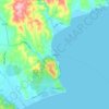
Mapa topográfico Mani
Haga clic en el mapa para ver la altitud.
Mani
Communities of low-growing alpine plants thrive above the tree line of the Taygetus range: examples are Clinopodium alpinum (rock thyme); Astragalus angustifolius (a species of milkvetch); and the rare Jurinea taygetea, an endemic species in the Jurinea genus. Montane forests dominated by Abies cephalonica (Greek fir) and Pinus nigra (European black pine) occur at moderate elevations.
Acerca de este mapa

Nombre: Mapa topográfico Mani, altitud, relieve.
Altitud media: 91 m
Altitud mínima: -2 m
Altitud máxima: 1.446 m
Otros mapas topográficos
Haga clic en un mapa para ver su topografía, su altitud y su relieve.

Koita
Greece > Peloponnese Region > Laconia Regional Unit > Oitylos Municipal Unit
Altitud media: 249 m


Αρεόπολη
Greece > Peloponnese Region > Laconia Regional Unit > Oitylos Municipal Unit
Altitud media: 200 m


Taygeti
Greece > Peloponnese Region > Laconia Regional Unit > Municipal Unit of Mystras
Altitud media: 806 m
Gythio
Greece > Peloponnese Region > Laconia Regional Unit > Gytheio Municipal Unit
Altitud media: 40 m
Taygeti
Greece > Peloponnese Region > Laconia Regional Unit > Municipal Unit of Mystras
Altitud media: 806 m