

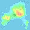
Mapa topográfico Karies
Haga clic en el mapa para ver la altitud.
Acerca de este mapa

Nombre: Mapa topográfico Karies, altitud, relieve.
Altitud media: 966 m
Altitud mínima: 746 m
Altitud máxima: 1.220 m
Otros mapas topográficos
Haga clic en un mapa para ver su topografía, su altitud y su relieve.

Mani
Greece > Peloponnese Region > Laconia Regional Unit
Communities of low-growing alpine plants thrive above the tree line of the Taygetus range: examples are Clinopodium alpinum (rock thyme); Astragalus angustifolius (a species of milkvetch); and the rare Jurinea taygetea, an endemic species in the Jurinea genus. Montane forests dominated by Abies cephalonica…
Altitud media: 91 m


Monemvasia
Greece > Peloponnese Region > Laconia Regional Unit > Gefyra > Monemvasia
Altitud media: 7 m
Monemvasia
Greece > Peloponnese Region > Laconia Regional Unit > Gefyra > Monemvasia
Altitud media: 7 m