Geolocalizar

Mapa topográfico Onoway (town)

Haga clic en el mapa para ver la altitud.

Acerca de este mapa

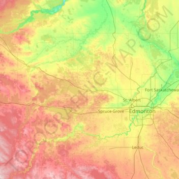
Nombre: Mapa topográfico Onoway (town), altitud, relieve.

Lugar: Onoway (town), Alberta, T0E 1V0, Canada (53.00667 -114.88829 54.40667 -113.48829)

Altitud media: 729 m

Altitud mínima: 581 m

Altitud máxima: 1.036 m

Otros mapas topográficos

Haga clic en un mapa para ver su topografía, su altitud y su relieve.

Calgary

Canada > Alberta

Calgary, Alberta, is uniquely positioned in the transition zone between the rolling Canadian Prairies to the east and the rugged foothills of the Canadian Rockies to the west, creating a landscape of undulating hills, plateau-like uplands, and deep river valleys. The Bow and Elbow Rivers carve prominent bluffs…

Altitud media: 1.106 m

Edmonton

Canada > Alberta

Edmonton is on the North Saskatchewan River, at an elevation of 671 m (2,201 ft). It is North America's northernmost city with a metropolitan population over one million. It is at the same latitude as Hamburg (Germany); Dublin (Ireland); Manchester (United Kingdom); and Magnitogorsk (Russia). It is south of…

Altitud media: 690 m

Strathmore

Canada > Alberta

Altitud media: 973 m

Peace River

Canada > Alberta

Altitud media: 434 m

Medicine Hat

Canada > Alberta

Altitud media: 708 m

Foothills County

Canada > Alberta

Altitud media: 1.196 m

Town of Castor

Canada > Alberta

Castor is a tourist town in Alberta, Canada. It is located at the intersection of Highway 12 and Highway 861, approximately 143 km (89 mi) east of the City of Red Deer. It has an elevation 816 m (2,677 ft).

Altitud media: 816 m

Banff

Canada > Alberta

Banff is a town within Banff National Park in Alberta, Canada. It is located in Alberta's Rockies along the Trans-Canada Highway, approximately 126 km (78 mi) west of Calgary and 58 km (36 mi) east of Lake Louise. At 1,400 to 1,630 m (4,590 to 5,350 ft) above sea level, Banff is the community with the second…

Altitud media: 1.421 m

Chestermere

Canada > Alberta

Altitud media: 1.035 m

Fort McMurray

Canada > Alberta > Wood Buffalo

The community lies at a lower elevation than most other parts of Alberta, so under the right conditions it can be a "hot spot" for Alberta.

Altitud media: 345 m

Whitecourt

Canada > Alberta

Whitecourt is a town in Northern Alberta, Canada that is surrounded by Woodlands County. It is approximately 177 km (110 mi) northwest of Edmonton and 279 km (173 mi) southeast of Grande Prairie at the junction of Highway 43 and Highway 32. It has an elevation of 690 m (2,260 ft).

Altitud media: 719 m

Town of Canmore

Canada > Alberta

Altitud media: 1.813 m

Municipality of Jasper

Canada > Alberta

Altitud media: 1.789 m

Grande Prairie

Canada > Alberta

Grande Prairie is located just north of the 55th parallel north, and is 465 km (289 mi) northwest of Edmonton, lying at an elevation of 669 metres (2,195 ft) above sea level. The city is surrounded by farmland to the north, east, and west. To the south lies a vast boreal forest with aspen, tamarack, lodgepole…

Altitud media: 665 m

Bragg Creek

Canada > Alberta

Altitud media: 1.384 m

Jasper National Park

Canada > Alberta

Altitud media: 1.782 m

Camrose County

Canada > Alberta

Altitud media: 748 m

Nose Hill Park

Canada > Alberta > Calgary

Names currently associated with topographical features in and near Nose Hill Park reflect the impact of the European newcomers and European trade goods on the Peigan. For example, Spy Hill, the westward extension of Nose Hill, derived its present name from the aboriginal practice of communicating with distant…

Altitud media: 1.174 m

Rimbey

Canada > Alberta

Altitud media: 913 m

Parkland County

Canada > Alberta

Altitud media: 751 m

Rocky View County

Canada > Alberta

Altitud media: 1.110 m

Town of Mayerthorpe

Canada > Alberta

Altitud media: 711 m

City of Lloydminster

Canada > Alberta

Altitud media: 650 m

Athabasca County

Canada > Alberta

Altitud media: 626 m

Village of Stirling

Canada > Alberta

Altitud media: 934 m

Strathcona County

Canada > Alberta

Altitud media: 691 m

Special Area No. 2

Canada > Alberta

Altitud media: 789 m

Village of Cremona

Canada > Alberta

Altitud media: 1.192 m

County of Stettler

Canada > Alberta

Altitud media: 813 m

Village of Alix

Canada > Alberta

Altitud media: 797 m

Town of Stettler

Canada > Alberta

Altitud media: 820 m

Special Area No. 3

Canada > Alberta

Altitud media: 744 m

City of Cold Lake

Canada > Alberta

Altitud media: 542 m

Village of Breton

Canada > Alberta

Altitud media: 848 m

Improvement District No. 04

Canada > Alberta

Altitud media: 1.778 m

Improvement District No. 9

Canada > Alberta

Altitud media: 1.848 m

City of Spruce Grove

Canada > Alberta

Altitud media: 699 m

Airdrie

Canada > Alberta

Altitud media: 1.112 m

Cardston County

Canada > Alberta

Altitud media: 1.141 m

Flagstaff County

Canada > Alberta

Altitud media: 708 m

Village of Warner

Canada > Alberta

Altitud media: 1.016 m

Clearwater County

Canada > Alberta

Altitud media: 1.443 m

Town of Barrhead

Canada > Alberta

The area contains dense stands of spruce, birch, pine and poplar. It also has some of the most fertile farmland in the province and is located between two major rivers, the Athabasca River and Pembina River. The Paddle River, a tributary of the Pembina River, flows directly through the town Barrhead. If you go…

Altitud media: 652 m

Town of Valleyview

Canada > Alberta

Altitud media: 705 m

Sturgeon River

Canada > Alberta

Altitud media: 703 m

Town of Swan Hills

Canada > Alberta

Altitud media: 1.136 m

Beaver County

Canada > Alberta

Altitud media: 695 m

Wabamun

Canada > Alberta

Altitud media: 737 m

Town of Oyen

Canada > Alberta

Altitud media: 763 m

Sturgeon County

Canada > Alberta

Altitud media: 681 m

Crow Lake

Canada > Alberta

Altitud media: 646 m

Mons Lake

Canada > Alberta

Altitud media: 620 m

Town of Athabasca

Canada > Alberta

Altitud media: 566 m

Lac La Biche County

Canada > Alberta

Altitud media: 624 m

Town of Cochrane

Canada > Alberta

Cochrane is situated at the base of Big Hill in the Bow River Valley. It sits at an elevation of 1,186 m (3,891 ft). The town is intersected by Highway 1A and Highway 22. Cochrane has a reputation for its western culture, which can easily be felt when one wanders the streets (particularly Main Street). The…

Altitud media: 1.200 m

Stony Plain

Canada > Alberta

Altitud media: 711 m

Census Division No. 18

Canada > Alberta

Altitud media: 927 m

Census Division No. 10

Canada > Alberta

Altitud media: 674 m

Town of Nanton

Canada > Alberta

Altitud media: 1.027 m

Mackenzie County

Canada > Alberta

Altitud media: 505 m

Town of Smoky Lake

Canada > Alberta

Altitud media: 632 m

Town of Cardston

Canada > Alberta

Altitud media: 1.166 m

Morinville

Canada > Alberta

Altitud media: 702 m

University of Calgary

Canada > Alberta > Calgary

Altitud media: 1.102 m

Sherwood Park

Canada > Alberta > Strathcona County

Altitud media: 691 m

Waterton Lakes National Park

Canada > Alberta > Improvement District No. 04

Operated by Parks Canada, Waterton is open all year, but the main tourist season is during July and August. The only commercial facilities available within the park are located at the Waterton Park townsite. This park ranges in elevation from 1,290 metres (4,232 ft) at the townsite to 2,910 m (9,547 ft) at…

Altitud media: 1.778 m

Fairview

Canada > Alberta

Altitud media: 605 m

Census Division No. 1

Canada > Alberta

Altitud media: 853 m

Census Division No. 3

Canada > Alberta

Altitud media: 1.290 m

Banff National Park

Canada > Alberta

Banff National Park has a subarctic climate with three ecoregions, including montane, subalpine, and alpine. The forests are dominated by Lodgepole pine at lower elevations and Engelmann spruce in higher ones below the treeline, above which is primarily rocks and ice. Mammal species such as the grizzly bear,…

Altitud media: 1.848 m

Village of Beiseker

Canada > Alberta

Altitud media: 916 m

McLean Creek

Canada > Alberta

Altitud media: 1.443 m

Leduc County

Canada > Alberta

Altitud media: 773 m

Town of Vulcan

Canada > Alberta

Altitud media: 1.051 m

Village of Hay Lakes

Canada > Alberta

Altitud media: 766 m

Town of Stavely

Canada > Alberta

Altitud media: 1.038 m

Census Division No. 4

Canada > Alberta

Altitud media: 762 m

Edmonton

Canada > Alberta > Edmonton

Altitud media: 677 m

Three Sisters Creek

Canada > Alberta

Altitud media: 1.379 m

Lethbridge

Canada > Alberta

Its high elevation of 929 m (3,048 ft) and close proximity to the Rocky Mountains provides Lethbridge with cooler summers than other locations in the Canadian Prairies. These factors protect the city from strong northwest and southwest winds and contribute to frequent chinook winds during the winter.…

Altitud media: 907 m

Brooks

Canada > Alberta > City of Brooks

Brooks is a city in southeast Alberta, Canada in the County of Newell. It is on Highway 1 (Trans-Canada Highway) and the Canadian Pacific Kansas City railway, approximately 186 km (116 mi) southeast of Calgary, and 110 km (68 mi) northwest of Medicine Hat. The city has an elevation of 760 m (2,490 ft).

Altitud media: 758 m

Huntington Hills

Canada > Alberta > Calgary

Altitud media: 1.101 m

Crescent Heights

Canada > Alberta > Calgary

Altitud media: 1.068 m