
Mapa topográfico Chatillon
Mapa interactivo
Haga clic en el mapa para ver la altitud.
Acerca de este mapa
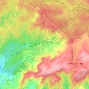
Nombre: Mapa topográfico Chatillon, altitud, relieve.
Altitud media: 340 m
Altitud mínima: 261 m
Altitud máxima: 397 m
Otros mapas topográficos
Haga clic en un mapa para ver su topografía, su altitud y su relieve.
Saint-Léger
Belgique > Luxembourg > Virton > Saint-Léger
Saint-Léger, Virton, Luxembourg, Wallonie, Belgique
Altitud media: 305 m