
Mapa topográfico Chihuahuan Desert
Mapa interactivo
Haga clic en el mapa para ver la altitud.
Acerca de este mapa
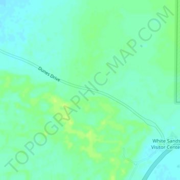
Nombre: Mapa topográfico Chihuahuan Desert, altitud, relieve.
Lugar: Chihuahuan Desert, Otero County, New Mexico, United States (32.78739 -106.18660 32.78749 -106.18650)
Altitud media: 1.221 m
Altitud mínima: 1.215 m
Altitud máxima: 1.228 m
There are several larger mountain ranges in the Chihuahan Desert, including the Sierra Madre, the Sierra del Carmen, the Organ Mountains, the Franklin Mountains, the Sacramento Mountains, the Chisos Mountains, the Guadalupe Mountains, and the Davis Mountains. These create "sky islands" of cooler, wetter, climates adjacent to, or within the desert, and such elevated areas have both coniferous and broadleaf woodlands, including forests along drainages and favored exposures. The lower elevations of the Sandia–Manzano Mountains, the Magdalena–San Mateo Mountains, and the Gila Region partly border the Chihuahuan Desert and partly border other ecoregions that are not deserts.
Otros mapas topográficos
Haga clic en un mapa para ver su topografía, su altitud y su relieve.
Mayhill
United States > New Mexico > Otero County
Mayhill, Otero County, New Mexico, United States
Altitud media: 2.104 m
Cloudcroft
United States > New Mexico > Otero County
Cloudcroft, Otero County, New Mexico, United States
Altitud media: 2.643 m
Bent
United States > New Mexico > Otero County
Bent, Otero County, New Mexico, 88314, United States
Altitud media: 1.857 m
Cloudcroft
United States > New Mexico > Otero County > Cloudcroft
Cloudcroft, Otero County, New Mexico, 88317, United States
Altitud media: 2.636 m
Sunspot
United States > New Mexico > Otero County
Sunspot, Otero County, New Mexico, 88349, United States
Altitud media: 2.626 m
Tularosa
United States > New Mexico > Otero County > Tularosa
Tularosa, Otero County, New Mexico, 88352, United States
Altitud media: 1.371 m