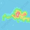
Mapa topográfico Kanakari
Haga clic en el mapa para ver la altitud.
Acerca de este mapa

Nombre: Mapa topográfico Kanakari, altitud, relieve.
Altitud media: 195 m
Altitud mínima: 57 m
Altitud máxima: 533 m
Otros mapas topográficos
Haga clic en un mapa para ver su topografía, su altitud y su relieve.

Naxos
Greece > South Aegean > Naxos Regional Unit
Naxos experiences both a Mediterranean climate (Csa) and a hot semi-arid climate (Köppen climate classification: BSh) depending on the location. According to the stations of the National Observatory of Athens, various locations in Naxos have a hot semi-arid climate. Inland areas of the island are much wetter…
Altitud media: 112 m